By Erin Lin
The village of West Father Long lies about five kilometers out of Kampong Thom town, Cambodia, in the southerly direction. Dirt paths run east and west, letting bicycles and farmers travel from the hamlet to the rice paddies, but the only route that travels with any suggestion of efficiency is Highway 6, a paved, two-lane road on which tour buses, jammed full, carry tourists from Phnom Penh, the capital, to the Angkor Wat ruins near Siem Reap. The landscape is remarkably verdant, but unattended: lopsided rectangular plots of paddy land; pools of fresh rainwater that fill the plots, bordered by raised clay to separate them; the rattan overgrowth and vine-like weeds that take over most paddies, except for certain edges near the dirt paths, where villagers have planted some rice seedlings.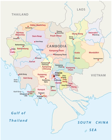
The loose, high-absorption soil, called Krakor locally, makes the land ideal for growing rice. For a good harvest, fertilizer need not be applied, nor irrigation lines installed. The village’s location, too, makes it easy to sell surplus rice since it is a short ride on Highway 6 to Kampong Thom market, the busiest in the province. But in reality, half the village’s plots lay fallow. Those who do cultivate their land only grow enough for their own consumption, planting 15 to 30% of their yield. No one brings their crop to market. And, most of the villagers are poor.
In 2012, the median amount a household spent on non-food items was $502 – for the entire year. This is approximately the cost of a used motorbike. By comparison, in Sweet Gum Tree village, only two and a half kilometers down the road, the median household spent $300 more on non-food purchases that same year. Here, the rice paddies are lush, well-tended, and planted 40 to 50% of their total capacity. Farmers produce triple the amount of rice as in West Father Long Village, both by weight and by price, and excess rice is sold to market.
Unlike in West Father Long, a thick layer of sandy soil, known as Prateah Lang, covers much of the area surrounding Sweet Gum Tree village. It is dry and constantly loses water, so irrigation tubes and makeshift water pumps are necessary to supplement the rain. When the water seeps through the surface soil to the subsoil, it takes nutrients with it. To help out the seedlings, most farmers spread chemical fertilizer after transplanting.
So why do people, where the land is worse, grow more rice and make more money – especially when farmers in both villages have good access to the nearby town market to sell their surplus? I believe part of the answer lies in the region’s history of conflict. Both villages were part of a targeted area in two US aerial strikes (one in 1971 and another in 1973). More than 12,000 unique bombs, weighing a total of 49,000 tons, were dropped in the district, an area roughly one-third the size of Manhattan.
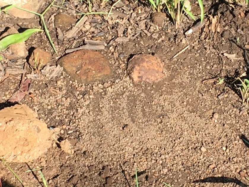
Between 1965 and 1973, Cambodians saw 500,000 tons of US Air Force ordnance drop onto its rice fields, villages, and people, in an effort to root out Vietnamese Communists from the Cambodian countryside. More than a half-century later, it seems as if the effect of the bombing is somewhat mixed. On some bombed land, one can see “crater lakes” in the rice paddies, visible pock-marks of the bombing, which do not seem to hinder agricultural production today. Other bombed areas remain untouched or sparsely planted. This paper examines the ecological consequences of the US bombing of Cambodia while answering a very basic question in comparative politics: what is the historical legacy of violence on development?
To answer this question, I explore the role of soil fertility and bombing intensity on present-day agricultural output and planting decisions. Within the weapons literature, it is common knowledge that fertile ground provides more of a cushion for the bomb upon impact; thus, the trigger fuse is less likely to detonate. I examine the long-term impact of this mechanical failure on land production. I find that, in fertile land, as the level of historic bombing intensity increases, today’s farmers are more likely to subsistence farm and produce less rice due to the risk of encountering unexploded ordnance. This mechanism does not apply to less fertile land: since it tends to be harder and drier, bombs were much more likely to explode upon impact.
I use a unique historical dataset of 114,000 sites targeted in 231,000 US Air Force sorties flown over Cambodia from 1965 to 1973. I identify the location and types of ordnance, and compare them to the 2012 agricultural output of 3,617 geo-referenced household plots. After matching household plots according to prewar economic and geographic conditions, I run a multi-level OLS model with an interacted term for a household plot’s exposure to bombs and land fertility. The findings support the hypothesis about the differential relationship between land fertility and the legacy of bombing. In highly fertile land, bomb intensity is significantly related to a decline in rice production and in the amount of rice sold to market. In less fertile land, the relationship is negligible. The results demonstrate empirical limits of macro-economic measures in the post-conflict reconstruction literature, and emphasize the impact that local ecological changes have on long-term development.

About the Author: Erin Lin is an Assistant Professor of Political Science and Global Food Politics at the Ohio State University. Lin was awarded the Best Paper in International Relations Award this spring for her research “How War Changes Land: A natural experiment of bomb-induced economic change in Cambodia” presented at the 2018 MPSA conference.